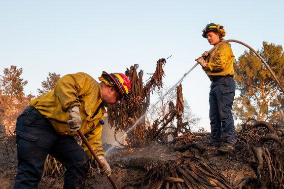
As the region works to put out devastating wildfires that started under similar conditions earlier this month, Santa Ana winds will reach the Los Angeles area once more this week, posing a serious risk of rapid fire spread.
For much of Ventura and Los Angeles counties, the highest red flag warning—a highly dangerous scenario alert—is in effect from Monday at noon local time (3 p.m. ET) until Tuesday at 10 a.m. (1 p.m. ET).
Seldom used, this extremely dangerous scenario warning alerts people to the high risk of fire spread caused by dry conditions and low humidity. In just three months since November, this is the fifth one to be issued. A PDS red flag warning is normally only issued by the National Weather Service once every four years. The last one was issued in 2020, and that was before November 2024.
Peak wind gusts of 50 to 70 mph are predicted for the valleys and beaches, and 60 to 100 mph for the foothills and mountains.
The region of greatest concern extends from Ventura County to Big Pines and Pomona in the east, over the San Fernando Valley to Malibu on the west coast.
Monday and at least Tuesday will see the development of very strong Santa Ana winds, which are dry, warm, and gusty winds that blow from Southern California’s inland toward the coast. The Los Angeles National Weather Service office cautioned that humidity levels would drop sharply to the single digits at the same time.
If any fires start, the winds, low humidity, and extremely dry vegetation will make for extremely dangerous fire weather conditions and quick fire spread.
Due to low humidity and strong Santa Ana winds, a red flag warning is in force for all other hours between 8 a.m. Monday and 10 p.m. Tuesday in the same areas.
The coastal regions of Malibu, the western Santa Monica mountains, the Calabasas and Agoura Hills, the San Fernando valleys, the Santa Susana mountains, the San Gabriel mountains and valley, the Santa Clarita Valley, and the beaches, inland coast, and central valleys of Ventura County are all under the warning.
Due to the strong Santa Ana winds and extremely low relative humidity, a fire weather watch is still in force for a significant portion of Ventura and Los Angeles counties from Tuesday night through Thursday night.
The weather agency advised residents to fill up their car and generator gas tanks, secure any loose outside goods, charge vital electronics and lighting devices, make an escape plan, and pack supplies in an emergency go bag.
This event’s wind gusts are expected to be lower than those that pounded the area earlier this month, which sparked the Palisades Fire and the Eaton Fire on January 7.
As of Monday, the Palisades Fire, which covers 23,713 acres and has destroyed over 12,000 houses, is 56% contained.
In the meantime, the Eaton Fire to the east is 81% contained as of Monday morning, having damaged nearly 9,000 buildings and scorched 14,021 acres in Pasadena, Altadena, and the Eaton Canyon.
At least 27 individuals lost their lives in the flames, which also caused widespread evacuations, hazy haze, poor air quality, and criticism of the government’s readiness.
Due to the weather alert, Governor Gavin Newsom declared on Sunday that he was prepositioning and moving over 130 fire engines, water tenders, and aircraft to Southern California.
Being in the right position at the right time is crucial, as demonstrated by the recent firestorms in Los Angeles. Crews can react more quickly and forcefully when specialist personnel and equipment are placed in wildfire-prone areas. “All families must remain vigilant because these conditions are dangerous,” Newsom stated in a statement.
According to the governor’s office, the state is rushing more resources even while thousands of people and pieces of equipment are still battling fires in the Los Angeles region.
