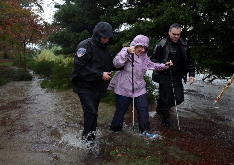
While an atmospheric river continued to pour heavy rain on California, forecasters warned of more strong winds coming to the stricken Pacific Northwest.
According to the tracking website poweroutage.us, more than 200,000 homes and businesses in Washington state, which was struck by winds of up to 70 mph this week as part of a “bomb cyclone” off the coast, were still without electricity Thursday night.
The storm started Tuesday and officials reported that two individuals were killed by falling trees in the state.
Additionally, a low pressure system offshore is expected to bring more high winds to the Pacific Northwest starting Friday, with forecasts ranging from 45 to 65 mph.
“Power outages are possible and unsecured items may get blown over,” the agency cautioned.
An “atmospheric river” in California poured more rain on the state’s northern region. According to the weather service, flooding will continue to be a hazard through Friday, with the highest risk of potentially fatal floods occurring on Thursday.
By Thursday evening, Santa Rosa, a city of about 170,000 people in Sonoma County, California, north of San Francisco, had received almost 10 inches of rain in just 48 hours, according to the city. The police agency advised everyone to avoid needless travel because roads and parking lots were inundated.
The storm was delivering snow to the Sierra Nevada. A semi slid off the highway Thursday, according to the California Highway Patrol in Truckee, and earlier this week, portions of crucial Interstate 5 close to the Oregon border were closed. Since then, they have reopened.
According to the Eureka, California, weather service, landslides and rockslides closed some or all of the lanes on highways in Humboldt and Lake counties.
Although only around 2.5 million people were under alerts, the meteorological agency’s website indicated that approximately 14 million people, including portions of California, were under winter storm warnings or winter weather advisories Thursday night.
According to the weather agency, a strong upper-level low that is passing across the area is bringing snow to Pennsylvania and New York state.
While there were no advisories in effect for New York City, forecasters in the region warned that certain parts of the lower Hudson Valley and northeastern New Jersey could receive up to 4 inches of precipitation or a combination of rain and snow.
Up to seven in the morning on Saturday, a winter weather warning was in effect for the Johnstown, Pennsylvania, area, which may receive up to a foot of snow accumulation. The meteorological service predicted that ridgetops would receive the most snowfall.
In the valleys, Binghamton and Ithaca, in upstate New York, might receive 1 to 4 inches of snow, and at elevations above 1,500 feet, up to a foot. Up until 4 p.m. on Friday, the region was under a winter weather warning.
Note: Thank you for visiting our website! We strive to keep you informed with the latest updates based on expected timelines, although please note that we are not affiliated with any official bodies. Our team is committed to ensuring accuracy and transparency in our reporting, verifying all information before publication. We aim to bring you reliable news, and if you have any questions or concerns about our content, feel free to reach out to us via email. We appreciate your trust and support!
