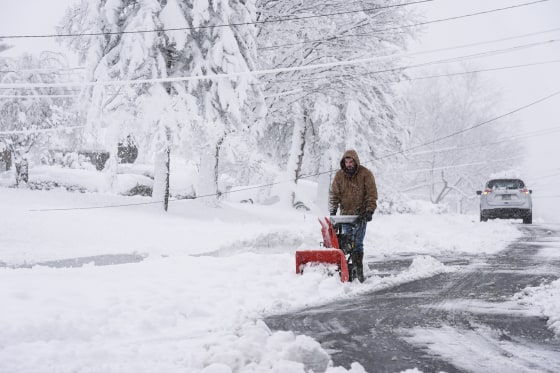
As millions of Americans prepare to return home from Thanksgiving, an arctic blast has delivered snow, frost, and dangerously cold winds to the Great Lakes, Midwest, and northern Plains, making travel “very difficult to impossible” on one of the busiest days of the year.
Travel-delaying lake-effect snow bands and showers have formed downwind of the Great Lakes in northeast Ohio, far northwest Pennsylvania, western New York, and parts of northwest New York, according to a National Weather Service advisory issued on Sunday.
New Yorkers were cautioned by Governor Kathy Hochul on Saturday to refrain from needless travel. In order to assist local communities, over 100 National Guard personnel were stationed in western New York, she stated in a statement.
After being blocked on Friday, Interstate 90 in western New York was reopened to passenger traffic Saturday afternoon, Hochul said, adding that commercial trucks were remained prohibited from traveling in both directions along the westernmost section of the interstate beginning at Exit 46.
According to the NWS, the greatest snow accumulations are anticipated east of Lake Ontario, where by early next week, isolated locations around the Watertown, New York, area may receive up to 60 inches of lake-effect snow.
According to the agency, Erie, Pennsylvania, has received 30 inches of snow, the most so far. By Tuesday, up to six feet of snow could cover the ground in northern Pennsylvania’s Erie County, according to federal forecasters.
Travel between Cleveland and Buffalo may be impacted by more than a foot of lake-effect snow in some areas of the region beginning at noon on Sunday and lasting until 7 a.m. on Tuesday, according to the Cleveland weather service office on Saturday.
In the Southtowns of Buffalo, bands of lake-effect snow will be active overnight, with up to two feet of snow and extremely dangerous traffic possible, according to the weather service office in Cheektowaga, New York, which covers Buffalo, on Saturday.
The Transportation Security Administration predicted earlier in November that Sunday would rank in the top three travel days of the year.
3.6 million people were under lake-effect snow warnings, 4.5 million were under freeze warnings, 8.5 million were under winter weather advisories, and 1 million were under frost advisories on Saturday, when more than 17 million people were under National Weather Service winter alerts.
According to the weather service, a cold airmass that flows south from Canada and beyond across the relatively warm Great Lakes swiftly draws part of the lake water into the atmosphere, creating fertile clouds that produce 2 to 3 inches of snow or more every hour. This process is known as “lake-effect snow.”
Although its impacts should subside by the beginning of next week, meteorologists cautioned that an Arctic air mass was still moving south from Canada and that colder air was still on its way south.
Note: Every piece of content is rigorously reviewed by our team of experienced writers and editors to ensure its accuracy. Our writers use credible sources and adhere to strict fact-checking protocols to verify all claims and data before publication. If an error is identified, we promptly correct it and strive for transparency in all updates, feel free to reach out to us via email. We appreciate your trust and support!
