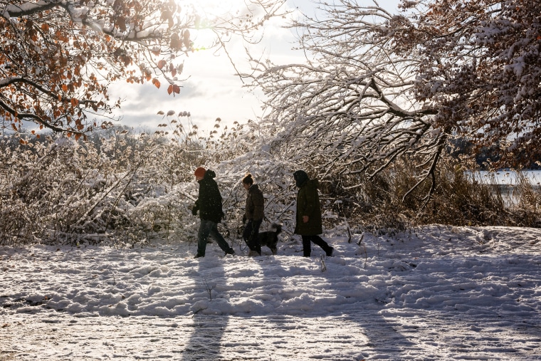
Tuesday morning was a snowy Christmas Eve for some people in the Northeast and mid-Atlantic.
In a meteorological system that created a layer of light to moderate snow before leaving the coast, the regions received up to an inch of snow, putting almost 20 million people under winter weather alerts.
While parts of northern New England received 2 to 6 inches of snow, and in some places even more, Tuesday’s snowfall ranged from a light dusting to an inch in several towns along the Interstate 95 corridor, including Washington, D.C., and New York City. According to earlier predictions, the mountains in Maine, New Hampshire, and Vermont will be the most severely affected.
People who must travel are being advised by the National Weather Service to drive carefully and slowly since the snow may be slippery.
The Federal Aviation Administration announced a nationwide ground stop for all American Airlines planes on Tuesday, temporarily halting travel on Christmas Eve. The airline claimed that the ground stop was caused by a vendor technological problem rather than bad weather.
Can locals anticipate a white Christmas, though? It doesn’t seem likely.
Conditions improved by Tuesday afternoon after the snow quickly moved out after only a few hours. The Northeast is expected to see chilly but dry conditions on Christmas Day.
Additionally, it is anticipated that the Northeast’s frosty weather will end during the weekend.
“Much of the East Coast region will have a moderation trend in the cold temperatures going into Christmas Eve, as the arctic surface high moves offshore and milder air from the Ohio Valley advects eastward across the region,” the National Weather Service stated.
Thunderstorms and locally heavy rainfall are being brought by showers that are moving across east Texas, southeast Oklahoma, and Arkansas in the middle of the country.
Small streams, low-lying areas, and several underpasses in the Dallas area were flooding as a result of the more than two inches of rain that had already fallen on the area as of Tuesday afternoon.
It was predicted that the rain would stop or at least lessen.
A storm system that is delivering mountain snow and a lot of rain to parts of California, Oregon, and Washington is still active in the West.
While the Sierra Nevada may receive up to a foot of snow, the coast from the Pacific Northwest into central California is predicted to receive between two and four inches of rain. Through Tuesday evening, the Sierra Nevada Mountains were still under a winter weather alert.
The weather service’s Bay Area field office warns residents to avoid the coast, where “dangerous and life-threatening beach conditions” with coastal flooding have been seen.
Three persons were sent into the ocean and suffered minor injuries when the Santa Cruz Wharf collapsed Monday due to strong storm seas.
As the next storm system moves toward the West Coast from the Pacific, it will bring more mountain snow, wind, and heavy rain to the area Wednesday night into Thursday. By Christmas Day, this storm will deliver some snow to the Rocky Mountains.
Note: Every piece of content is rigorously reviewed by our team of experienced writers and editors to ensure its accuracy. Our writers use credible sources and adhere to strict fact-checking protocols to verify all claims and data before publication. If an error is identified, we promptly correct it and strive for transparency in all updates, feel free to reach out to us via email. We appreciate your trust and support!
